In today’s world, location-based services are more critical than ever. Whether you’re developing a travel app, a delivery service, or a real estate website, integrating geographical data can significantly enhance your service. One essential tool for accessing geographical data is the geocoding API. This blog post will guide you through the process of using a geocoding API, explaining its importance, setup, and practical applications.
What is a Geocoding API?
A geocoding API is a service that allows you to convert addresses into geographical coordinates (latitude and longitude) and vice versa. This process is called geocoding and reverse geocoding. Geocoding helps applications map an address to a location on the Earth’s surface, while reverse geocoding converts geographical coordinates into a readable address.
Why Use a Geocoding API?
Enhancing User Experience
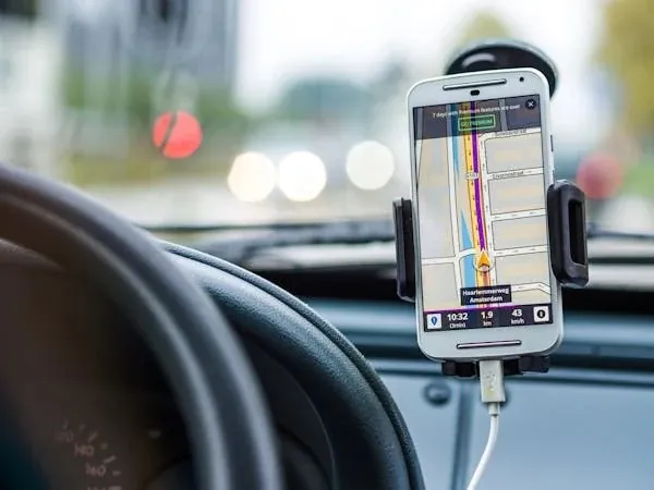
Incorporating geocoding into your application can greatly improve the user experience. Users can input an address and see it pinpointed on a map instantly. For example, ride-sharing apps use geocoding to allow users to set pick-up and drop-off locations accurately.
Data Accuracy
Geocoding APIs provide accurate location data, which is crucial for services that rely on precise geographical information. This is especially important for applications like emergency services, logistics, and navigation.
Automating Processes
Geocoding APIs automate the process of converting addresses into coordinates, saving time and reducing errors compared to manual entry. This automation is beneficial for businesses dealing with large datasets, such as real estate listings or e-commerce delivery systems.
Setting Up Your Geocoding API
Step 1: Choose a Geocoding API Provider
There are several geocoding API providers available, each with its own features and pricing models. Popular options include Google Maps Geocoding API, OpenCage Geocoding API, and Distance Matrix AI. For this tutorial, we will focus on using the Distance Matrix AI Geocoding API.
Step 2: Get Your API Key
To use the Distance Matrix AI Geocoding API, you need to sign up for an account and obtain an API key. The API key is a unique identifier that allows you to access the service. You can usually find this option in the account settings or API section of the provider’s website.
Step 3: Understand the API Documentation
Before making any requests, it’s essential to read through the API documentation provided by your chosen provider. The documentation includes information on how to structure your requests, available parameters, response formats, and error handling.
Making Your First Geocoding Request
Step 1: Construct the API Request URL
To make a geocoding request, you need to construct a URL that includes your API key and the address you want to geocode. Here is an example of how to structure the request URL for the Distance Matrix AI Geocoding API:
ruby
Копіювати код
https://api.distancematrix.ai/maps/api/geocode/json?address=1600+Amphitheatre+Parkway,+Mountain+View,+CA&key=YOUR_API_KEY
In this URL:
- https://api.distancematrix.ai/maps/api/geocode/json is the base URL for the geocoding service.
- address=1600+Amphitheatre+Parkway,+Mountain+View,+CA is the address you want to geocode. Spaces are replaced with + symbols.
- key=YOUR_API_KEY is your unique API key.
Step 2: Send the Request
You can send the request using various methods, such as an HTTP client in your programming language or a simple web browser. Here’s an example using Python and the requests library:
python
Копіювати код
import requests
url = “https://api.distancematrix.ai/maps/api/geocode/json”
params = {
“address”: “1600 Amphitheatre Parkway, Mountain View, CA”,
“key”: “YOUR_API_KEY”
}
response = requests.get(url, params=params)
data = response.json()
print(data)
Step 3: Parse the Response
The response from the API will be in JSON format. You’ll need to parse this response to extract the geographical coordinates. Here’s how you can do it in Python:
python
Копіювати код
if data[‘status’] == ‘OK’:
results = data[‘results’]
location = results[0][‘geometry’][‘location’]
latitude = location[‘lat’]
longitude = location[‘lng’]
print(f”Latitude: {latitude}, Longitude: {longitude}”)
else:
print(“Geocoding failed.”)
Practical Applications of Geocoding API
Real Estate
Real estate websites can use geocoding APIs to show property listings on a map, making it easier for users to visualize locations. By converting addresses into coordinates, users can filter properties based on their preferred locations.
Delivery Services
Delivery services rely heavily on accurate location data. Geocoding APIs help ensure that deliveries are made to the correct addresses by converting the inputted addresses into precise coordinates for navigation.
Travel and Tourism
Travel apps can use geocoding APIs to enhance user experiences by providing detailed maps and routes to attractions, hotels, and restaurants. Users can search for places and see them mapped out, making trip planning more efficient.
Emergency Services
Emergency services use geocoding APIs to locate incidents quickly. By converting a caller’s address into coordinates, dispatchers can send help to the exact location without delays.
Handling Errors and Limitations
Rate Limits
Most geocoding API providers impose rate limits on the number of requests you can make in a given time period. Exceeding these limits can result in errors or additional charges. Make sure to read the provider’s terms and manage your request rate accordingly.
Accuracy Issues
Geocoding accuracy can vary based on the provider and the quality of the input data. Ensure that addresses are formatted correctly and use fallback methods if the geocoding results are not as expected.
Error Handling
Always implement error handling in your application to manage failed geocoding requests. This can include retries, logging errors, and providing user-friendly messages.
Incorporating a geocoding API into your application can significantly enhance its functionality by providing accurate and automated location data. By following the steps outlined in this guide, you can easily set up and start using a geocoding API. Whether you’re improving user experience, ensuring data accuracy, or automating processes, geocoding APIs are invaluable tools for modern applications.