A powerful new storm system is threatening millions across the United States (US) just days after a deadly cross-country storm left a path of devastation.
Although this latest storm differs from the previous one, it is expected to unleash severe thunderstorms, trigger fast-moving wildfires, and bring blizzard conditions to parts of the central US.
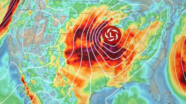
According to CNN, the storm began forming over the Rockies on Tuesday afternoon and was forecast to move into the Plains by nightfall, strengthening significantly as it heads toward the Midwest. Even before fully developing, the system was already generating hazardous dust storms by late Tuesday morning.
Strong winds are expected to be the most widespread danger, with gusts exceeding 40 mph forecast across a 1,300-mile stretch from Texas to Minnesota on Wednesday. These winds have the potential to topple trees and power lines, posing a significant threat to communities along the storm’s path.
The persistent weather pattern gripping the US since early March has led to a repeating cycle of severe storms, with forecasters warning of more familiar hazards in the days ahead.
As the storm began to take shape, gusty winds swept across parts of the southern Rockies and Plains on Tuesday, sharply increasing the potential for wildfires. The Storm Prediction Center issued a warning of a “likely wildfire outbreak.”
A critical level 3-of-3 fire weather risk was declared for parts of New Mexico, Texas and Oklahoma, where dry vegetation and gusts reaching 60 mph could easily ignite and spread fires. “A few gusts could approach 80 mph, especially in eastern New Mexico,” forecasters noted.
On Wednesday, the wildfire risk will persist, with a level 2-of-3 fire weather risk in place for areas in western and southern Texas, where frequent gusts of 30 to 40 mph are expected. Although stronger winds will occur farther north as the storm intensifies, the most severe fire danger will remain in the drought-stricken southern Plains.
The heightened fire danger follows a weekend of deadly wildfires. “More than 130 wildfires fueled by high winds from the last storm damaged at least 400 homes and killed four people in separate counties in Oklahoma,” according to the state’s Department of Emergency Management.
The same storm system has also stirred up dangerous dust storms. “Strong winds also started to kick up dirt and debris and create blinding dust storms Tuesday morning.” By early Tuesday afternoon, dust storm warnings were in place across parts of New Mexico, Texas and Kansas as gusts over 50 mph swept through the region.
Dust storms can drastically reduce visibility and air quality, making driving especially perilous. “There is no safe place on a highway when a dust storm hits,” the National Weather Service in El Paso, Texas, warned Tuesday.
The dangers of such storms were evident last Friday, when “at least eight people in Kansas and four people in Texas were killed in car crashes” as dust storms reduced visibility to near zero.
As the system continues eastward, snow is expected to fall across the Plains Tuesday night and reach parts of the Midwest by Wednesday morning. Heavier snow accumulation, more than half a foot is possible from eastern Nebraska to Michigan’s Upper Peninsula by Wednesday night.
ALSO READ: At least 12 dead after Honduras plane crashes into the water
Although a few inches of snow in March may not typically disrupt life in the Plains and Midwest, strong, sustained winds could turn these conditions into something far more dangerous.
Blizzard conditions could emerge as strong gusts combine with snowfall to create whiteout conditions. “Whiteouts are possible even in spots where just an inch of snow falls because of the strength of Wednesday’s gusts — more than 50 mph in parts of Nebraska, Iowa and Minnesota.”
The National Weather Service in Des Moines, Iowa, issued a stark warning about the travel risk: “Travel in blizzard conditions could be ‘treacherous and potentially life-threatening.’”
ALSO READ TOP STORIES FROM NIGERIAN TRIBUNE
WATCH TOP VIDEOS FROM NIGERIAN TRIBUNE TV
- Relationship Hangout: Public vs Private Proposals – Which Truly Wins in Love?
- “No” Is a Complete Sentence: Why You Should Stop Feeling Guilty
- Relationship Hangout: Friendship Talk 2025 – How to Be a Good Friend & Big Questions on Friendship
- Police Overpower Armed Robbers in Ibadan After Fierce Struggle